The evolution of the proglacial lake Memphremagog (extracts)
Paul Boissonnault and Q. H. J. Gwyn 1983
Résumé de l'article
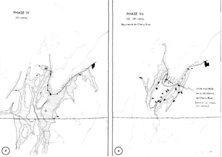
During the final deglaciation of the Appalachians, the proglacial Lake Memphremagog flooded the valleys immediately east of the Sutton Mountains. The lake first occupied northern Vermont, very close to the 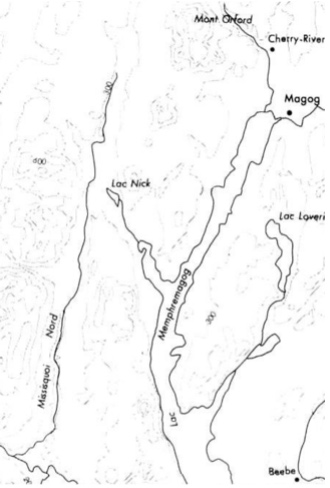 international border. It then invaded, in Quebec, the valleys of present-day Lake Memphremagog, the Missisquoi River and, finally, the Saint-François. A detailed study of the deposits on the eastern slope of the Memphremagog basin allows us to reconstruct the evolution of the proglacial lake and, consequently, that of glacial retreat. Eight lacustrine phases occurred between altitudes of 365 m and 165 m. One of them, phase Va, helps to redefine the position of the front associated with the Cherry-River moraine. During this evolution, deglaciation occurred in two ways. During phases I to Va, the ice, still active, formed a lobe supported on the eastern slope. Subsequently, the front retreated further north; the ice became stagnant and fragmented, thus isolating small ice caps in the valleys of Lake Magog and the Massawippi River.
Boissonnault, P. & Gwyn, Q. H. J. (1983). L’évolution du lac proglaciaire Memphrémagog, sud du Québec. Géographie physique et Quaternaire, 37(2), 197–204. https://doi.org/10.7202/032514ar
Phase V
Meanwhile, the ice clears the Missisquoi River pass and the lake level drops. The outlet of Lake Nick then comes into action and maintains the lake level in the Lake Memphremagog basin at 245 m above sea level near Ayer's Cliff, at about 230 m near Beebe.
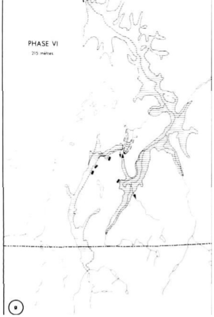
Phase VI
The retreat of the glacial front beyond Richmond allows the proglacial Lake Memphremagog, until then confined to the Saint-François River basin, to communicate with the Saint-Laurent lowlands. The lake level stabilizes at 215 m and, as a result, the outlet of Lake Nick is no longer active.
Fig 2g
Conclusion (excerpt)
About 14,900 years ago, the proglacial Lake Memphremagog flooded northern Vermont and, progressively, the central Eastern Townships. The lake probably existed until the invasion of the Champlain Sea 12,500 years ago (HILLAIRE-MARCEL and OCCHIETTI 1980). This proglacial lake was the main lake of the late Wisconsinan in the Eastern Townships, and the study of its evolution contributes to a better understanding of the deglaciation of the region.
For those who want to delve deeper into the subject:
https://www.erudit.org/fr/revues/gpq/1983-v37-n2-gpq1916/032514ar.pdf